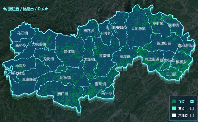
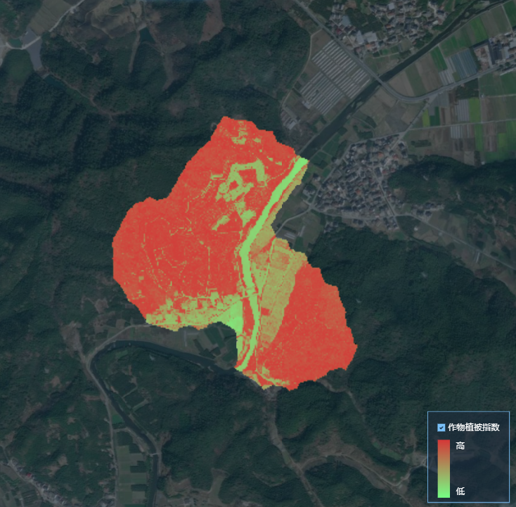
一、添加数据源
添加数据源
// addSource.jsimport { geoUrl } from '@/fetch/env'// 添加mapbox sourceexport default function addSource(map, source = []) {for (const name of source) {if (name) {map.addSource(name, {type: 'vector',scheme: 'tms',tiles: [`${geoUrl}/geoserver/gwc/service/tms/1.0.0/linanAI%3A${name}@EPSG%3A900913@pbf/{z}/{x}/{y}.pbf`],})}}}// 页面引入后使用方法this.fileUrlArr = [leizhuShpUrl, riceShpUrl] // 此处为数据源地址数组// 添加对应的数据源和突出await addSource(this.mapboxInstance, [...this.fileUrlArr])
二、增
默认添加 symbol(符号),line(线),fill(填充),background(背景),raster(栅格)
点图层—> icon图标、文字
export default async function addBaseLayer(map) {
  const imageList = [
    {
      url: require('@/assets/images/common/base_icon.png'),
      usedName: 'base-marker',
    },
  ]
  for (const item of imageList) {
    await new Promise((resolve, reject) => {
      const existImage = map.hasImage(item.usedName)
      if (existImage) resolve()
      else {
        map.loadImage(item.url, function (error, image) {
          if (error) {
            reject()
          }
          map.addImage(item.usedName, image)
          resolve()
        })
      }
    })
  }

  await map.addLayer({
    id: `base-layer`,
    source: `base`, // 数据源的名称
    'source-layer': `base`, // 数据源的图层
    type: 'symbol',
    filter: true,
    layout: {
        // 图标类属性
      'icon-image': `base-marker`, // 图标的图片名称
      'icon-size': 0.8, //
      'icon-allow-overlap': true, // 是否允许图标重叠
      "icon-offset": [0, 0], // 图标的偏移量(可选,默认值为 [0, 0])

      // 文本类属性
      "text-field": "", // 文本所对应的字段
      "text-size": 16, // 文本的大小(默认值为 16,单位:像素)
      "text-max-width": 10, // 文本的最大宽度,超过则折行(可选,默认值为 10,单位:ems)
      "text-line-height": 1.2, // 文本的行高(默认值为 1.2,单位:ems)
      "text-letter-spacing": 0, // 文本的字符间距(默认值为 0,单位:ems)
      "text-justify": "center", // 文本的水平对齐方式(可选值为 auto、left、center、right。默认值为 center)
      "text-rotate": 0, // 文本的顺时针旋转角度
      "text-padding": 2, // 文本的外边距
      "text-offset": [0, 0], // 文本的偏移量
    },
    paint: {
        // 图标类属性(需要设置 icon-image)
        "icon-opacity": 1, // 图标的不透明度
        "icon-halo-color": "rgba(0,0,0,0)", // 图标的光晕颜色
        "icon-halo-width": 0, // 图标的光晕宽度
        "icon-halo-blur": 0, // 图标的光晕模糊宽度
        "icon-translate": [0, 0], // 图标的平移
        "icon-translate-anchor": "map", // 图标的平移锚点,即相对的参考物(可选值为 map、viewport,默认为 map)

        // 文本类属性(需要设置 text-field)
        "text-opacity": 1, // 文本的不透明度
        "text-color": "#000000", // 文本的颜色
        "text-halo-color": "rgba(0,0,0,0)", // 文本的光晕颜色
        "text-halo-width": 0, // 文本的光晕宽度
        "text-halo-blur": 0, // 文本的光晕模糊宽度
        "text-translate": [0, 0], // 文本的平移
        "text-translate-anchor": "map", // 文本的平移锚点,即相对的参考物(可选值为 map、viewport,默认为 map)
    },
  })
}
线图层
// 添加线 addLinanLayer.js
// 添加临安图层
export default function addLinanLayer(map) {
  return new Promise(async (resolve, reject) => {
    try {
      // 添加临安边界
      await map.addLayer({
        id: 'linan_boundary-layer', // 唯一 图层id
        source: 'region_linan',  // 数据源的名称
        'source-layer': 'region_linan',  // 数据源的图层
        type: 'line', // 类型
        layout: { // // 布局类属性
          'line-cap': 'round',
          'line-join': 'round',
        },
        paint: { // 绘制类属性
          'line-color': borderColor,
          'line-width': 2,
        },
      })
      resolve()
    } catch (err) {
      reject(err)
    }
  })
}
面:shp图层 (矢量图)

// 添加竹图斑图层
export default function addLinanLayer(map) {
  return new Promise(async (resolve, reject) => {
    try {
      // 添加竹图斑
      await map.addLayer({
        id: 'plant1_spot-layer', // 唯一 图层id
        source: 'bamboo_maozhu_plant_spot',  // 数据源的名称
        'source-layer': 'bamboo_maozhu_plant_spot',  // 数据源的图层
        type: 'fill', // 类型
        "minzoom": 0, // 最小层级(可选,取值范围为 0 ~ 24。当 style 的 zoom 小于此 minzoom 时,layer 将被隐藏)
        "maxzoom": 24, // 最大层级(可选,取值范围为 0 ~ 24。当 style 的 zoom 大于此 maxzoom 时,layer 将被隐藏)
        layout: { // // 布局类属性
          "visibility": "visible", // 可见性(可选,可选值为 none、visible,默认值为 visible)
        },
        paint: { // 绘制类属性
          "fill-opacity": 1, // 填充的不透明度(可选,取值范围为 0 ~ 1,默认值为 1)
          "fill-color": "#000000", // 填充的颜色
          "fill-outline-color": "#000000", // 描边的颜色
          "fill-translate": [0, 0], // 填充的平移
        },
      })
      resolve()
    } catch (err) {
      reject(err)
    }
  })
}
面:tif图层(png图片)

import { geoUrl } from '@/fetch/env'
// 加载tif图
export default function addTifLayer(map, sourceTifList, isHide = false) {
  return new Promise(async (resolve, reject) => {
    try {
      for (const tifName of sourceTifList) {
        if (tifName) {
          map.addLayer({
            id: tifName,
            type: 'raster', //这里要用raster ,因为切片得到的是图片
            source: {
              type: 'raster', //切片地图使用png 所以这里设置为raster
              tiles: [
                `${geoUrl}/geoserver/gwc/service/wmts?SERVICE=WMTS&REQUEST=GetTile&LAYER=linanAI:${tifName}&TILEMATRIX=EPSG:900913:{z}&TILEMATRIXSET=EPSG:900913&format=image%2Fpng&TileCol={x}&TileRow={y}`,
              ],
            },
            "source-layer":'source-layer-name',
            tileSize: 256,
            // minzoom: 15.5,
            "paint": { // 绘制类属性
                "raster-opacity": 1, // 图片的不透明度
            }
          })
        }
      }
      resolve()
    } catch (err) {
      reject(err)
    }
  })
}
三、删
// 删除图层+删除数据源
this.mapboxInstance.removeLayer(`图层id`)
this.mapboxInstance.removeSource(`图层id`)

// 不删除图层 仅隐藏
this.mapboxInstance.setFilter(`图层id`, false)
// 显示图层
this.mapboxInstance.setFilter(`图层id`, true)
四、改
// 移动图层位置
this.mapboxInstance.moveLayer(`图层id`, `beforeId`)
// beforeId(string?)用来插入新图层的现有图层 ID。
// 如果该参数(argument)被省略,该图层将会被添加到图层最上层。
五、查/过滤
// A & B & C
filter: [
      'all',
      ['match', ['get', 'code'], A, ['match', ['get', 'taski_id'], B, ['match', ['get', 'id'], C, true, false], false], false],
    ],
// A || B || C
filter: [
      'all',
      ['any', [
          ['match', ['get', 'type'], A, true, false],
          ['match', ['get', 'type'], B, true, false],
          ['match', ['get', 'type'], C, true, false]
        ]
      ],
    ],
六、事件
// 初始化绑定对应事件
async initMapbox(map) {
    // 存储 mapbox 地图实例
    this.mapboxInstance = map
    // 添加数据源
    // 添加图层
    this.bindClickEvent(this.mapboxInstance)
},

// 地图绑定点击事件
bindClickEvent(map) {
  map.on('click', '图层id', async (e) => {
    e.preventDefault()
    let properties = e.features[0].properties
   // 此处可拿到点击后的图层信息
    console.log('properties: ', properties)
    const lonAndLat = [Number(properties.longitude), Number(properties.latitude)]
    let popup = new mapboxgl.Popup({
      className: 'popup',
      closeOnClick: true,
    })
    popup.setLngLat(lonAndLat).setHTML('<div id="dialog-moadl"></div>').addTo(this.mapboxInstance)
    // PointDetailModal 为自定义的弹窗组件
    const MapInsectWarnModal = Vue.extend(PointDetailModal)
    new MapInsectWarnModal({
      propsData: {
        detail: properties,
      },
    }).$mount('#dialog-moadl')
    let closeBtn = document.getElementsByClassName('close-icon')[0]
    closeBtn.addEventListener('click', () => {
      popup.remove()
    })
  })
},

// 清除默认弹窗样式
::v-deep .mapboxgl-popup {
  z-index: 99;
  .mapboxgl-popup-tip {
    display: none;
  }

  .mapboxgl-popup-content {
    background: none;
    padding: 0;
  }

  .mapboxgl-popup-close-button {
    display: none;
  }
}

// PointDetailModal 组件
<template>
  <div class="point-detail-modal">
    <div class="close-icon"></div>
    <div class="box">
     <!-- 弹窗基本内容 -->
    </div>
  </div>
</template>
<script>
export default {
  props: {
    detail: {
      required: true,
    },
  },
}
</script>

